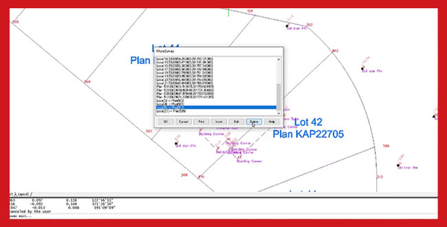
Today’s video highlights another practical function included in MicroSurvey CAD.
The 2D Helmert’s Transformation included in MicroSurvey CAD is a powerful tool that can be used for a variety of coordinate transformations. With the Helmert’s Transformation, you can rotate, shift, and scale up to 5000 points based upon a best fit solution using 2 to 500 pairs of common coordinate points, all with the execution of a single command.
A minimum of two points common in both the plan and local systems are needed to be able to solve the four unknown transformation parameters. This gives what is known as a unique solution. When more than two points are common in each system, redundancy exists, and a least squares method is used to determine the optimum transformation parameters.
In this video, we demonstrate the utility by working through a real-world example. A survey dataset collected for a Real Property Report in assumed local coordinates is brought into MicroSurvey CAD. The data is then transformed to align with a base drawing containing actual ground control coordinates.

